Cómo llegar a Monteverde sin perder el día: las tres rutas y cuál conviene
A Monteverde se llega por tres caminos distintos y solo uno está asfaltado de punta a punta. Escoger mal no le cuesta veinte minutos: le puede costar la tarde entera y una llegada de noche por un camino de lastre.
Monteverde está a 1 400 metros de altura, en lo alto de la cordillera de Tilarán. Esa altura es justamente lo que crea el bosque nuboso — y también lo que complica llegar. No hay una carretera principal que suba: hay tres accesos, cada uno desde un lado distinto de la montaña, y son muy diferentes entre sí.
Manejamos las tres varias veces por semana. Esto es lo que hay que saber antes de escoger.
Ruta 606, desde la Interamericana
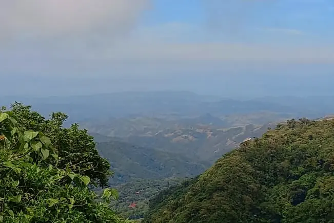
Es la subida desde el Pacífico. Se sale de la Interamericana en el desvío de Rancho Grande —el punto de referencia es una gasolinera Full— y son unos 36 kilómetros hasta Santa Elena.
Está asfaltada completa. Este es el dato que más ha cambiado en los últimos años y el que mucha información en internet todavía no refleja: durante décadas esta subida fue de lastre, y todavía hoy encuentra blogs advirtiendo de piedra suelta y huecos. Ya no. El asfalto llega hasta Santa Elena.
Sube unos 45 minutos a una hora desde el desvío. Es una carretera de montaña, angosta y con curvas cerradas, pero es carretera de verdad.
Si viene del aeropuerto
Desde el SJO son unas 3 horas y media, y desde Liberia unas 3 horas. En ambos casos la ruta natural es la Interamericana y la 606. Es el acceso que usamos para casi todos los traslados desde aeropuerto.
Ruta 145, por Tilarán
Este es el acceso desde el norte, el que se usa viniendo de La Fortuna o de la zona del lago Arenal. Se bordea el lago por la ruta 142 hasta Tilarán, y de ahí se toma la 145 hacia el sur.
Aquí es donde todavía hay lastre. Saliendo de Tilarán la carretera está asfaltada un tramo corto y después se convierte en camino de tierra y piedra. Es un camino transitado y en condición razonable, no es una trocha, pero son varios kilómetros de traqueteo hasta que vuelve a empalmar con la 606 asfaltada cerca de Santa Elena.
De Tilarán a Monteverde es hora y media. De La Fortuna, contando el rodeo del lago, entre tres horas y media y cuatro.
El cruce en bote desde La Fortuna
La tercera opción no es una carretera sino una combinación: van en microbús hasta el muelle del lago Arenal, cruzan el lago en lancha unos 30 minutos, y del otro lado los recoge otro vehículo que sube a Monteverde.
Toma alrededor de tres horas en total, así que es más rápido que rodear el lago por tierra, y la travesía en lancha con el volcán de fondo es de las vistas más bonitas del viaje.
Tiene dos peros. El primero es que hay que cambiar de vehículo dos veces, con todo el equipaje. El segundo es que el lago Arenal es de los lugares más ventosos del país: cuando sopla fuerte, especialmente entre diciembre y abril, las lanchas pueden suspender el cruce. Siempre hay que tener el plan B por tierra.
Cuál escoger
| Viene de | Ruta | Tiempo | Superficie |
|---|---|---|---|
| Aeropuerto SJO | Interamericana + 606 | 3 h 30 | Asfalto todo |
| Aeropuerto Liberia | Interamericana + 606 | 3 h | Asfalto todo |
| La Fortuna, por tierra | 142 + 145 por Tilarán | 3 h 30 – 4 h | Tramo de lastre |
| La Fortuna, cruzando | Bote por el lago | 3 h | Dos transbordos |
| Manuel Antonio | Costanera + 606 | 4 h 30 | Asfalto todo |
| Tamarindo | Interamericana + 606 | 3 h 30 | Asfalto todo |
La regla simple: si viene del sur o del oeste, la 606 y listo. Si viene de La Fortuna, escoja entre el bote —más rápido y más bonito, pero con transbordos y sujeto al viento— y la vuelta por Tilarán, que es más larga y con lastre pero no depende del clima.
Tres cosas que nadie le dice
Salga temprano, sí, pero no por el tráfico
En Monteverde la nubosidad y la llovizna suben con las horas. Una salida a las 7 de la mañana suele significar llegar con luz y con el bosque despejado; salir a mediodía a menudo significa llegar entre neblina. No es una cuestión de tráfico sino de montaña.
Empaque el abrigo arriba, no en la maleta grande
La diferencia térmica sorprende a todo el mundo. Puede salir de Tamarindo con 32 grados y llegar a Santa Elena con 15 y viento. Tenga a mano una chaqueta y algo impermeable — en el bosque nuboso llovizna prácticamente todo el año.
El GPS a veces manda por caminos que no debe
Waze y Google Maps ocasionalmente sugieren atajos por caminos vecinales de lastre que son más cortos en kilómetros y mucho peores en realidad. Si va manejando, confirme que va por la 606 o la 145 y no le haga caso a un desvío que le prometa ahorrar diez minutos.
Lo esencial
La 606 desde la Interamericana está asfaltada completa y es la mejor opción desde cualquier punto del sur o del oeste. Desde La Fortuna, el bote es más rápido pero depende del viento. Y salga temprano: la montaña se nubla en la tarde.
Getting to Monteverde without losing a day: the three roads and which to take
Three different roads climb to Monteverde and only one is paved the whole way. Choosing wrong does not cost you twenty minutes — it can cost you the afternoon and a night arrival on gravel.
Monteverde sits at 1,400 metres, high on the Tilarán mountain range. That altitude is exactly what creates the cloud forest — and exactly what makes getting there awkward. There is no single main highway up: there are three approaches, each from a different side of the mountain, and they are very different from one another.
We drive all three several times a week. Here is what to know before you choose.
Route 606, from the Interamericana
This is the climb from the Pacific side. You leave the Interamericana at the Rancho Grande turnoff — the landmark is a Full petrol station — and it is about 36 kilometres up to Santa Elena.
It is fully paved. This is the detail that has changed most in recent years and that a lot of information online still has not caught up with: for decades this climb was gravel, and even today you will find blogs warning about loose stone and potholes. Not any more. The asphalt runs all the way to Santa Elena.
The climb takes 45 minutes to an hour from the turnoff. It is a mountain road — narrow, with tight bends — but it is a real road.
Coming from an airport
From SJO it is about three and a half hours; from Liberia about three. In both cases the natural route is the Interamericana and then the 606. It is the approach we use for nearly every airport transfer.
Route 145, via Tilarán
This is the northern approach, the one you use coming from La Fortuna or the Lake Arenal area. You skirt the lake on Route 142 to Tilarán, then take the 145 south.
This is where gravel still remains. Leaving Tilarán the road is paved for a short stretch and then turns to dirt and stone. It is a well-travelled road in reasonable condition — not a track — but it is several kilometres of rattling before it rejoins the paved 606 near Santa Elena.
Tilarán to Monteverde is an hour and a half. From La Fortuna, counting the loop around the lake, three and a half to four hours.
The boat crossing from La Fortuna
The third option is not a road but a combination: a minibus to the Lake Arenal dock, a 30-minute boat crossing, and another vehicle waiting on the far side to drive you up to Monteverde.
It takes about three hours door to door, so it is faster than driving around the lake, and the crossing with the volcano behind you is one of the finest views of the whole trip.
Two caveats. First, you change vehicles twice, with all your luggage. Second, Lake Arenal is one of the windiest places in the country: when it blows hard, especially between December and April, boats can suspend the crossing. Always have the overland plan B.
Which to choose
| Coming from | Route | Time | Surface |
|---|---|---|---|
| SJO airport | Interamericana + 606 | 3 h 30 | Fully paved |
| Liberia airport | Interamericana + 606 | 3 h | Fully paved |
| La Fortuna, overland | 142 + 145 via Tilarán | 3 h 30 – 4 h | Gravel section |
| La Fortuna, crossing | Boat across the lake | 3 h | Two transfers |
| Manuel Antonio | Costanera + 606 | 4 h 30 | Fully paved |
| Tamarindo | Interamericana + 606 | 3 h 30 | Fully paved |
The simple rule: if you are coming from the south or the west, take the 606 and stop thinking about it. If you are coming from La Fortuna, choose between the boat — faster and far prettier, but with transfers and at the mercy of the wind — and the loop through Tilarán, which is longer and part gravel but weather-proof.
Three things nobody tells you
Leave early, but not because of traffic
In Monteverde the cloud and drizzle build through the day. A 7 a.m. departure usually means arriving in daylight with the forest clear; leaving at midday often means arriving inside a cloud. This is mountain weather, not rush hour.
Pack the jacket on top, not in the big suitcase
The temperature swing catches everyone out. You can leave Tamarindo at 32 °C and reach Santa Elena at 15 °C with wind. Keep a jacket and something waterproof within reach — the cloud forest drizzles nearly year-round.
Your GPS will sometimes send you down roads it should not
Waze and Google Maps occasionally suggest shortcuts along rural gravel lanes that are shorter in kilometres and far worse in practice. If you are driving yourself, confirm you are on the 606 or the 145 and ignore any detour promising to save you ten minutes.
The short version
The 606 from the Interamericana is fully paved and the best option from anywhere south or west. From La Fortuna the boat is faster but wind-dependent. And leave early — the mountain clouds over in the afternoon.
¿Va para Monteverde?
Heading to Monteverde?
Le decimos por cuál ruta lo llevamos y cuánto cuesta, con el precio final por vehículo. Sin sorpresas al llegar.
We will tell you which road we take you on and what it costs, as a final price per vehicle. No surprises on arrival.